Oakland’s history is one of dramatic transformation. Home to the Ohlone, what were once vast grasslands, forests and tidal flats, were fundamentally reshaped by the arrival of Spanish and American settlers in the 18th century.
When the city was incorporated in 1852, it quickly morphed from a rural land dotted with country houses to a railroad and transportation mecca, then to an important industrial hub with a large working class.
Today’s Oakland still has clues from its colorful past. Many of the Town’s historic structures still stand, old railroad tracks peak through newer concrete roads and remnants of wooden piers still jut out into the Bay. Meanwhile, festivals, attractions and transportation systems have come and gone, only to be replaced by new ones.
To illustrate these changes, we dove into the archives of the Oakland History Center at the Oakland Public Library and selected historical images depicting different parts of the city. Then we carefully tracked down their location using Google Maps, visible landmarks, and information written on the back of the photos.
While reporting on this story, we intentionally selected geographically diverse images to represent Oakland’s varied neighborhoods. However, certain districts are not as well documented, and the few photos that do exist feature ambiguous locations that were difficult to pinpoint.
Pergola at Lake Merritt
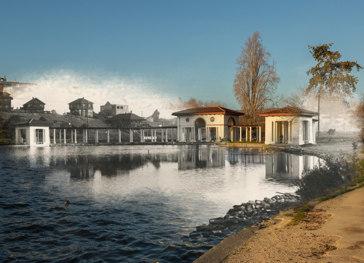
The Pergola and Colonnade at Lake Merritt circa 1901. Lake Merritt was originally a tidal flat called the San Antonio Slough. The Pergola and Colonnade structures were part of an effort to turn the lakeside area into a public park and were designed by architect Walter Reed, along with the later additions such as the bandstand, bowling greens with a clubhouse, according to a 2005 report commissioned by the city of Oakland. The pergola structure was nicknamed “El Embarcadero” because it was said that boats received and delivered cargo for early settlers in the same location. The cross street behind the pergola still bears the name El Embarcadero in honor of the structure.
Peralta Playland
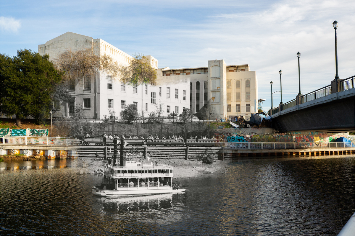
Children and parents ride the Lil’ Belle Riverboat and The Little Acorn train at Peralta Playland, circa 1952. At the opposite end of Lake Merritt, Children’s Fairyland once had a competitor in Peralta Playland, an amusement park in the lake’s estuary next to the Kaiser Convention Center. The park featured performances and rides such as the riverboat and a miniature steam train. A 1966 article in the Oakland Tribune advertises a gala anniversary featuring “clowns, music, square dancing, topsy turvy train, robberies, free, balloons, contests and prizes.” Staged train robberies were a popular event at Peralta Playland and there was even a ride that simulated a rocket ship. The park ran from 1950 to 1968.
In the background, the Paul Robeson Administration Building still stands abandoned since a custodian left the faucet on and flooded the building in 2013. The structure was once the Oakland Unified School District’s headquarters until they were forced to move due to significant structural damages. HYArchitects, a firm hired to assess the cost of repairs to the site, determined that a revamp would cost more than the price of a new build and recommended demolishing the building. A new plan for OUSD headquarters is in the works under the name The Marcus Foster Education Leadership Complex.
Haddon Hill and Lake Merritt
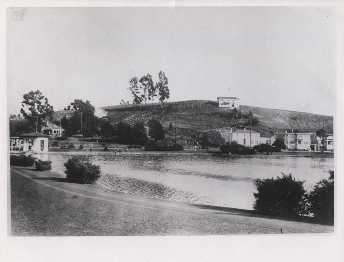
Haddon Hill, largely undeveloped, is viewed from across Lake Merritt circa 1915. Historical photo courtesy of the Oakland History Center. Photo by Saskia Hatvany.
Grand Avenue and Piedmont

An early automobile carries two passengers up an unpaved Grand Avenue from Lake Merritt towards Piedmont in 1908. The house on the left slope still stands in the same location over 100 years later. In the 1880s, only seven houses stood where Piedmont is now, but following a destructive earthquake in 1906, many residents fled San Francisco to seek safety in the East Bay. According to the city of Piedmont, the population of the area increased tenfold in one year following the quake. Still sparsely populated in 1908, residents Hugh Craig and James Ballentine filed papers with the State of California to incorporate the 1.8 square mile city.
East 17th Street and Fruitvale
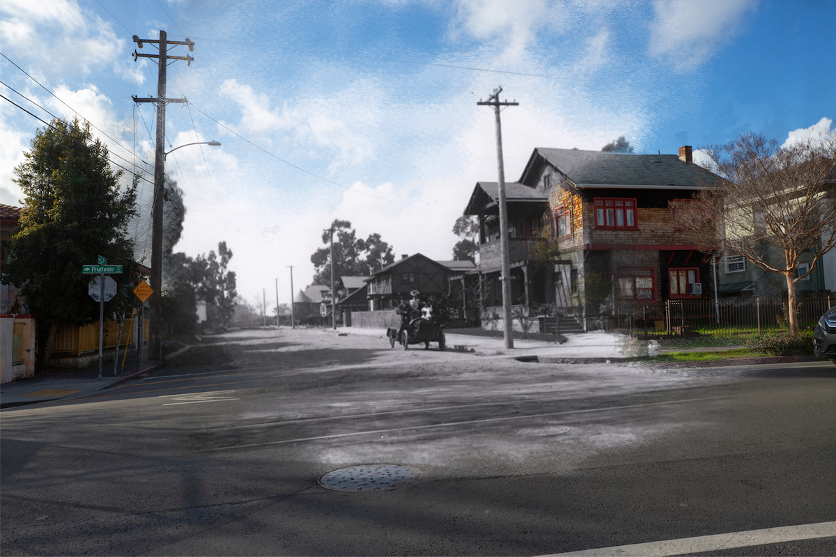
A family sits in their automobile on East 17th Street, looking west onto Fruitvale Avenue in the Fruitvale District circa 1910. The Fruitvale District got its name from its once vast expanses of fruit orchards. In the 1960s and 70s, the area experienced an increase in population and became a center for the Chicano Movement. Since then, the neighborhood has remained an important Latino community.
The Eagles’ Street Fair and Carnival in Fruitvale
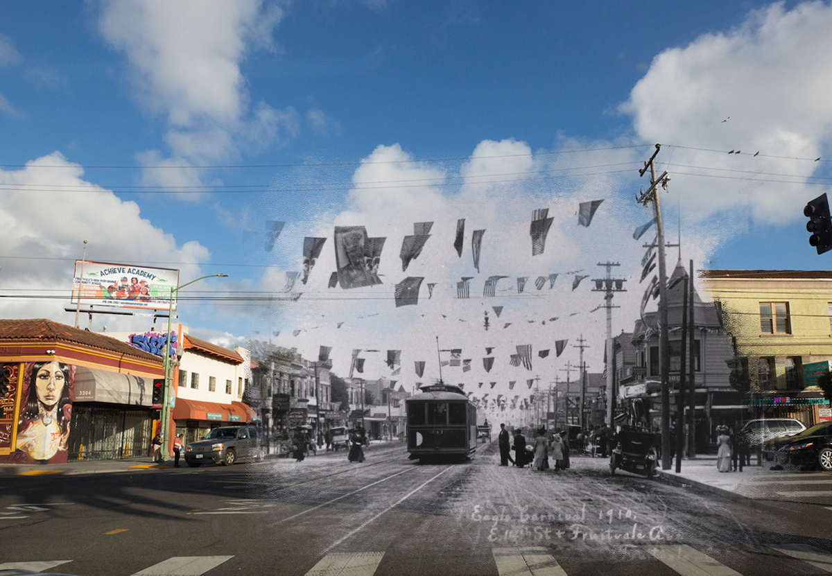
A streetcar at the intersection of East 14th Street (now International Boulevard) and Fruitvale Avenue, decorated for the Eagles’ Street Fair and Carnival in the Fruitvale District circa 1910. The Eagles’ Street Fair and Carnival was a weeklong festival held in Fruitvale in May, which culminated in a Mardi Gras parade complete with floats, confetti and a masked ball. An Oakland Tribune article from May 3, 1910 mentions open-air concerts, aerial performances, and contests including a “baby show.” The festivities would end with the coronation of the festival queen.
West Oakland Car Crash

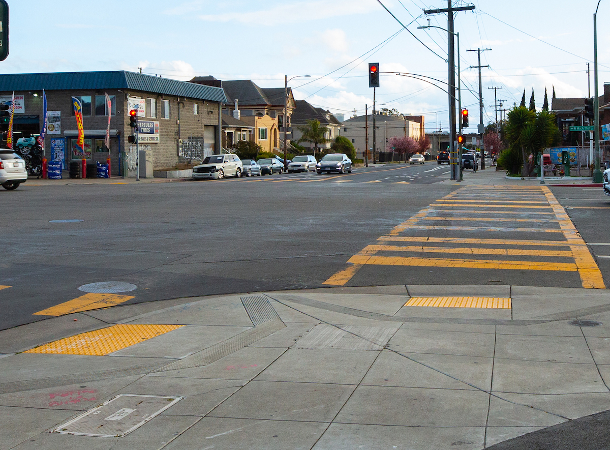
A car crash on the corner of Market Street and West MacArthur Boulevard in West Oakland, circa 1955. The Victorian-era house in the background is still intact today, and represents a time when West Oakland was one of the first western settlements in the East Bay and a bustling port. Later, the shoreline around West Oakland was landfilled — an area that now houses today’s Port of Oakland. Historical photo courtesy of the Oakland History Center. Photo by Saskia Hatvany.
15th Street and Broadway
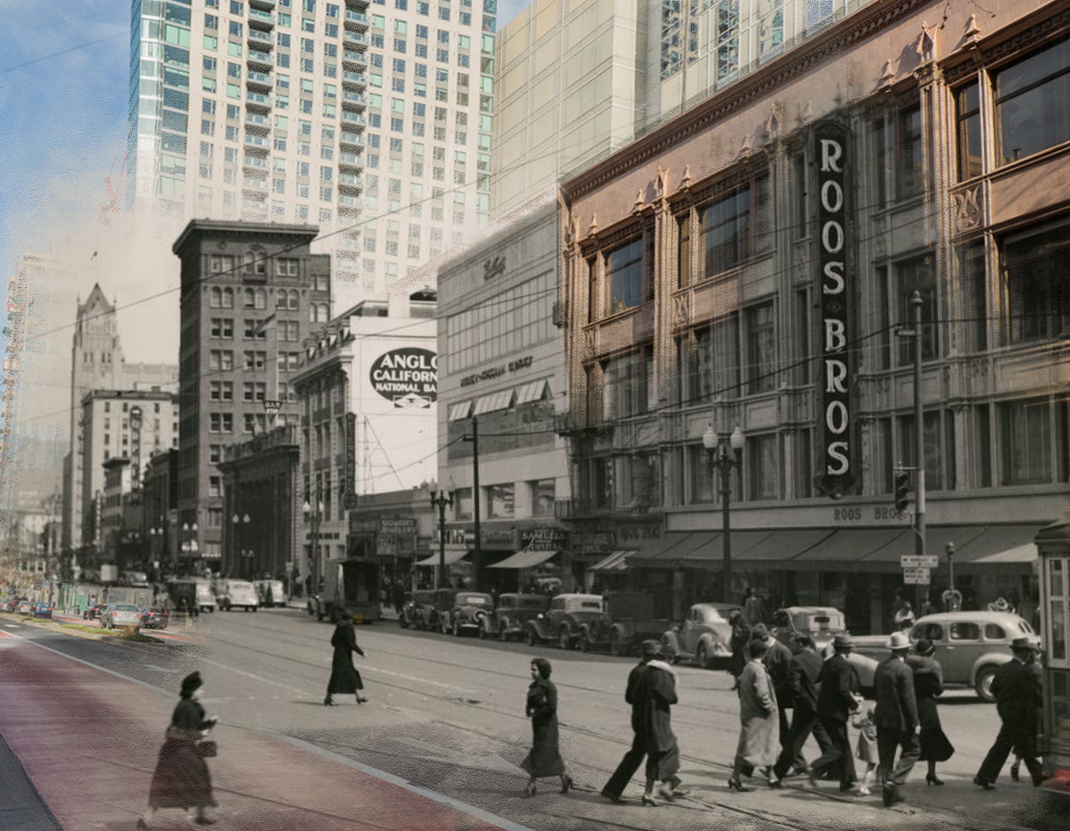
Passengers board a streetcar at 15th Street and Broadway circa 1945. Streetcars were an important feature of Oakland’s transportation until the 1960s. Before the original Bay Bridge structure opened in 1936, San Francisco-bound passengers would take streetcars to the end of an 11,000-foot pier that extended into the Bay. There, passengers boarded ferries bound for San Francisco. In the background is the Roos Brothers Building, which was originally built to house S.M. Friedman’s women’s apparel store, according to a 1925 article in the Oakland Tribune. The Roos Brothers Building still stands today, but other buildings on the block have been torn down and now high rises dominate the skyline.
Frank Ogawa Plaza

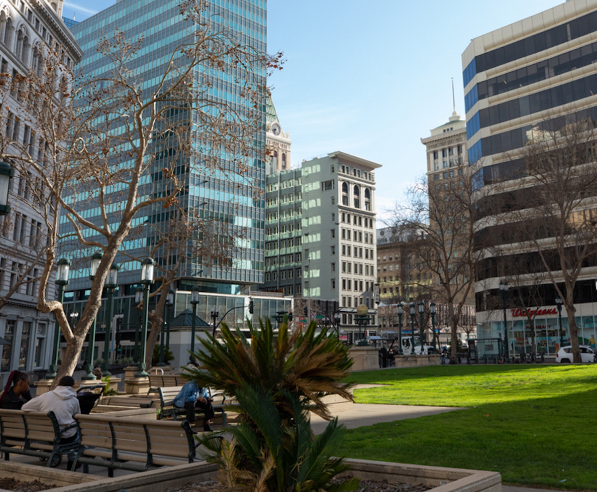
14th Street runs past City Hall Park (now Frank H. Ogawa Plaza), circa 1907. The Tribune Building base was constructed in 1906, but the tower that’s still an iconic part of Oakland’s skyline wasn’t built until 1923. Historical Photo Courtesy of the Oakland History Center. Photo by Saskia Hatvany.
Jingletown and the docks
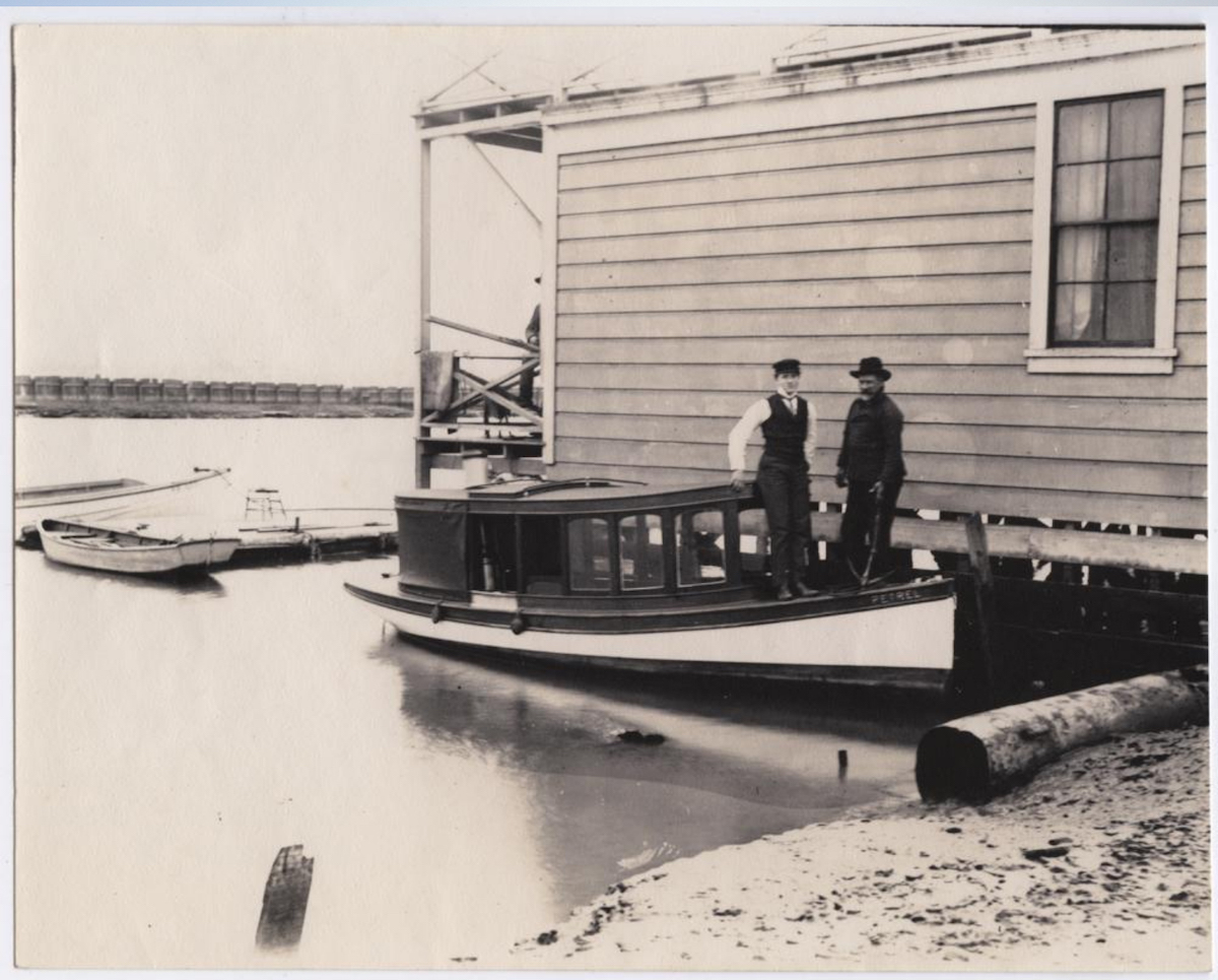
Circa 1910, two men stood on the bow of the boat Petrel while docked at a boathouse at the end of Derby Avenue in Jingletown, which was once called the Kennedy Tract. The area was home to The California Cotton Mills, the largest cotton mill west of the Mississippi River. The plant was closed in 1954 but the main factory building still stands today and is home to the California Cotton Mills Studios, a live-work space that houses artisans in lofts. Historical photo courtesy of the Oakland History Center. Photo by Saskia Hatvany.
MacArthur Boulevard in Dimond

Looking west on Hopkins Street, now MacArthur Boulevard, in the Dimond commercial district. The large building in the background on the left is The Altenheim, a senior residence that still stands today. The Altenheim was founded in the 1890s by immigrants from German-speaking countries and the structures mostly date from the 1910s. Historical photo courtesy of the Oakland History Center. Photo by Saskia Hatvany